Graham Leslie McCallum
The tree of happiness flowers and fruits most abundantly for the creative man
GARDINER STREET – DURBAN – A PICTORIAL HISTORY
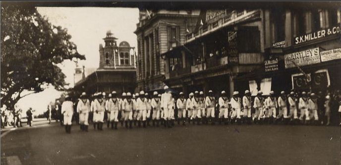
Even though much of the financial and social activity of the City of Durban has left the old town – Gardiner Street, that lies at its heart, still attracts events, especially the annual Armistice Day remembrance service, when members of the Moths, Scottish Pipers, South African Army and Citizenry gather to remember those Durbanites who fell in battle during World War 1 and 2. Each year I follow the marching pipers down the street to the impressive and colourful Art Deco-styled Great War Memorial that lies adjacent to the street.
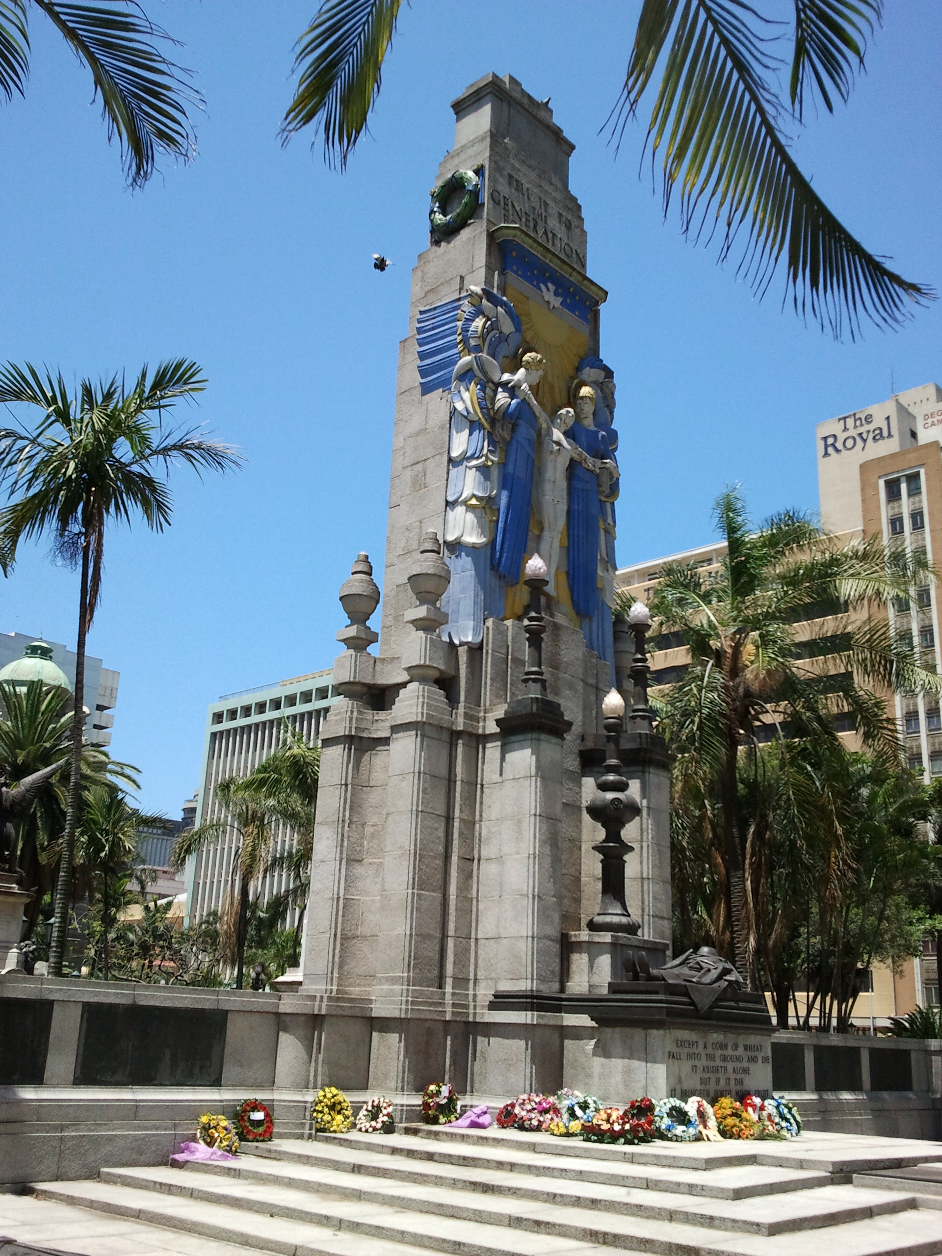
Leading the march are the bagpipers and drummers, their bagpipes wailing stirringly and their drums echoing loudly from the tall buildings. They are followed by the soldiers, their boots beating the pace on the tarmac and the Men of the Tin Hats bearing their shellhole banners high.
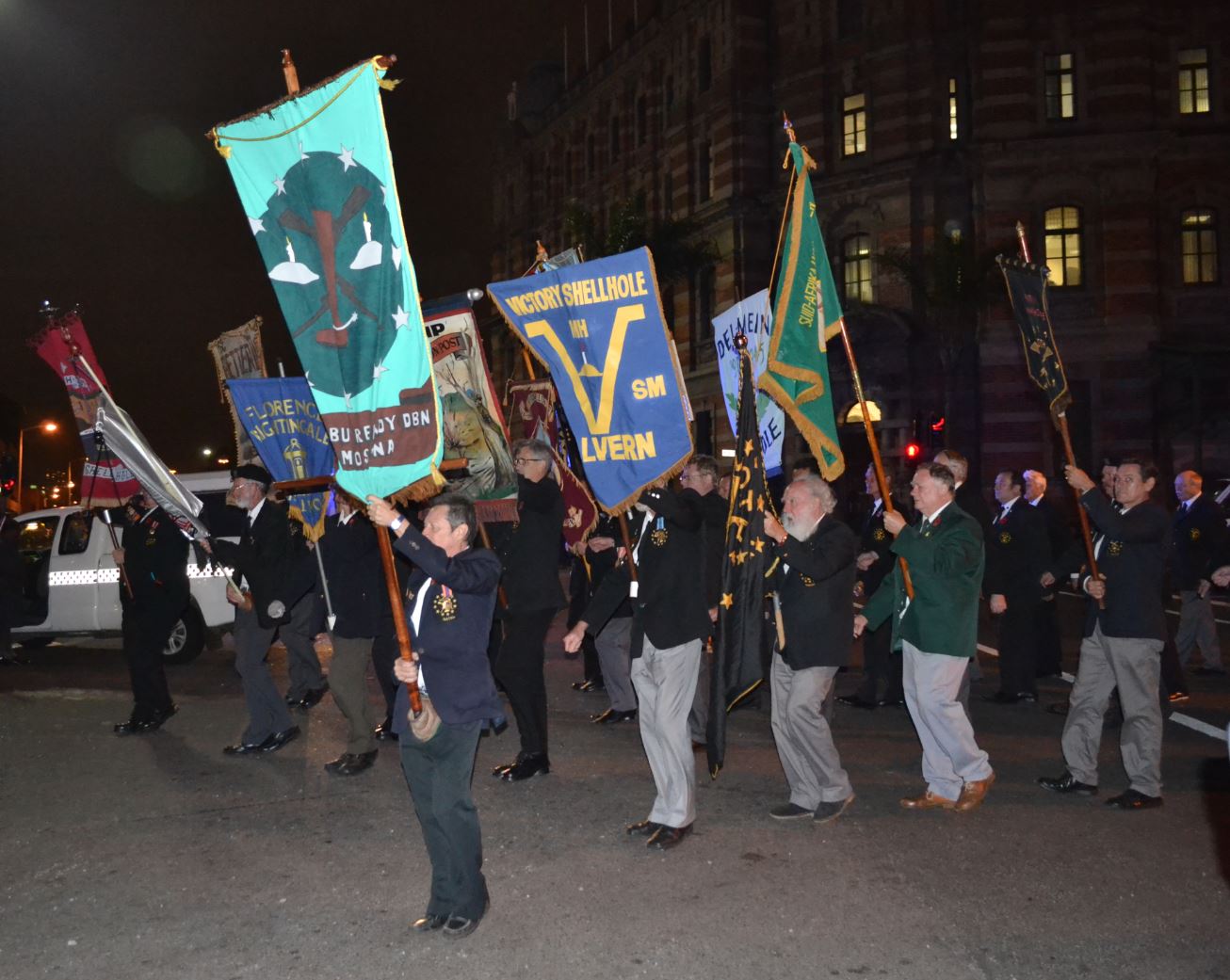
(above and below) A photograph of soldiers and military cadets marching and on parade in Gardiner Street, 1920’s.
I love that this event still graces this historic street and all connection to its past is not lost in the present dispensations headlong sprint to destroy and subjugate everything to do with Durban’s pioneering past. Just because you change the name of a street and substitute it for another, does not ‘unhappen’ those early pioneers of the 1820’s contribution anymore than one can Shaka or Cetshwayo.
And this brings us to Captain Allen Francis Gardiner, the first missionary to the Zulu people. Today the vast majority of the 5.5 million Zulu nation are Christians. His faithfulness to the gospel can therefore hardly be underestimated.
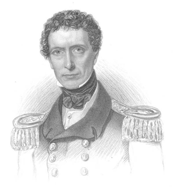
(above) Allen Francis Gardiner.
Gardiner arrived at the Bay of Natal in the year 1834, having traveled overland from the Eastern Cape. He immediately traveled the country, visited the Zulu King Dingane at his royal kraal ‘umGungunglovu’.

(above) A remarkable watercolour painting by Gardiner of the Zulu monarch Dingane in beaded dance dress, who was half-brother to Shaka Zulu, the first king of the Zulus.
It was on returning to the Bay of Natal after failing to require the necessary permission to establish a mission in Zululand, that the Trading-Settlers at the Bay asked Gardiner to set up a mission at the Bay. Among these English traders were Richard Wood, C. Blanckenberg, John Cane, Charles Adams, J. Francis, C. J. Pickman, P. H. Ogle and James Collis.
Gardiner set about establishing a small and rustic mission station atop the ridge just west of the sandy plane upon which the town of Durban was built. He named his mission station ‘Berea’ after the Greek city mentioned in the Book of Acts, and at this location he brought the good news and education to the approximate 2500 Zulus resident at the Bay. These people were the wards of the 30 European pioneers and under their protection after they and their families had fled to the Bay from the wrath of Dingane and certain death. These refugees placed the traders in an invidious position, for harbouring them was provocation enough to having the Zulu army descend on them all. The fact that they protected these people is testament to their civility and courage. Present at the Bay were also several Koi and people of mixed descent. Among them A Koi women called Rachel who was the wife of John Cane.
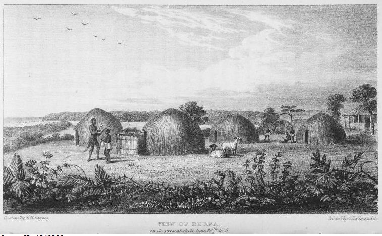
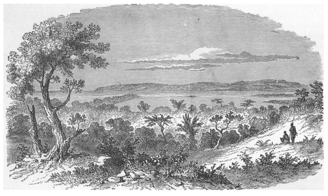
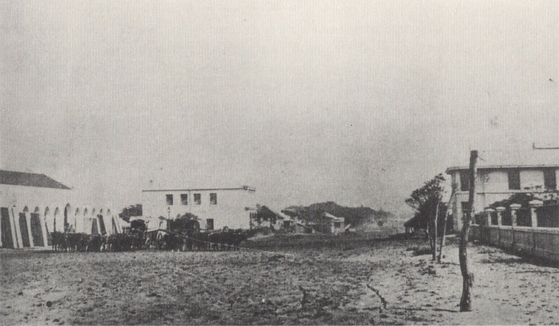
(above) Gardiner’s mission station ‘Berea’. One can see the Bay of Natal, the Bluff and the Point in the distance.
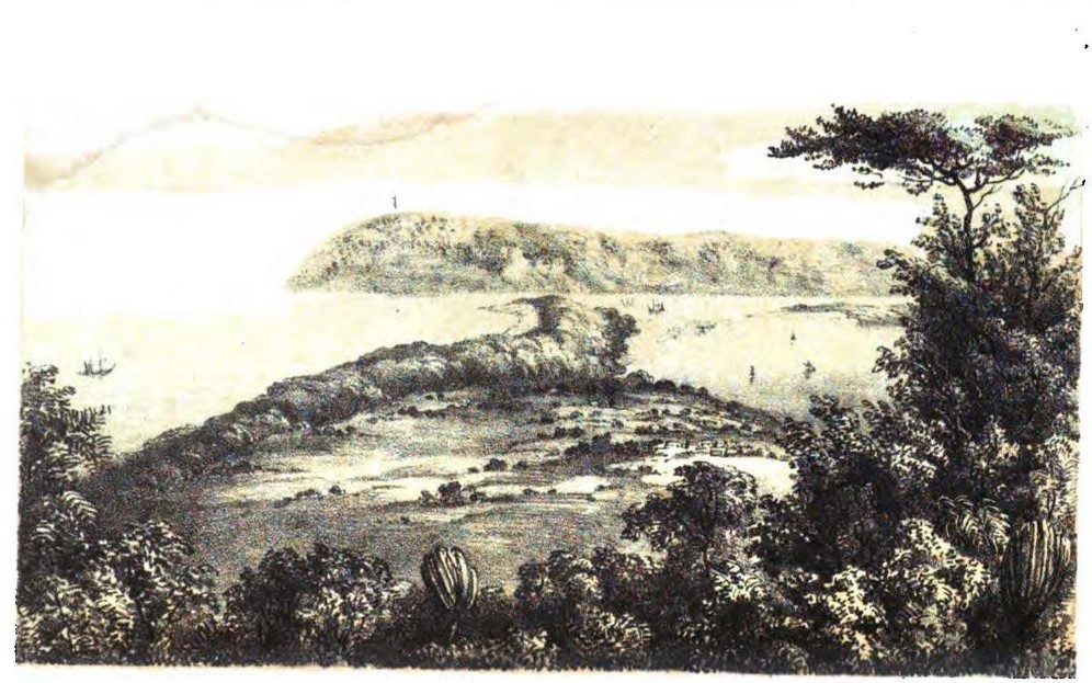
(above) An early illustration (Lithograph) of the Point, Plane, Bay of Natal and Bluff, sketched from Captain Gardiner’s station in 1855.
(above) An engraving of Port Natal taken from the Berea Mission Station. This image appeared in Capt. Gardiner’s book ‘Narrative of a Journey to the Zoolu Country’ published in 1836.
Allen was the fifth son of Samuel Gardiner and Mary Boddam of Coombe Lodge, Oxfordshire. He was born on the 28th of January in 1794. After a religious education he entered the Royal Navy College at Portsmouth. After a career in the Navy and reaching the rank of Commander, his interests a devout Christian turned to the foreign mission field.
Gardiner was among the English Pioneers who gathered one afternoon on the 23rd of June 1834 in the hut of Mr. Berkin to discuss whether or not to establish a town at the Bay of Natal. On agreeing to this, the party immediately scouted the sandy plane alongside the bay for a suitable location. Gardiner’s humourous account is worth transcribing in full… “This’ll do,” cried one;-“That’s the spot,” exclaimed another. After some minutes of such-like random conversation, the whole party were compactly collected, and the business at length entered upon, and conducted in a rational manner, every proposition being subjected to the votes of those who were present, and carried or negatived accordingly. It was in this impromptu manner that the town of D’Urban was named – its situation fixed – the township and church lands appropriated – and, in short, as much real business gone through as would have required at least a fortnight’s hard writing and debating in any other quarter of the globe”.
And thus was the city of Durban born.
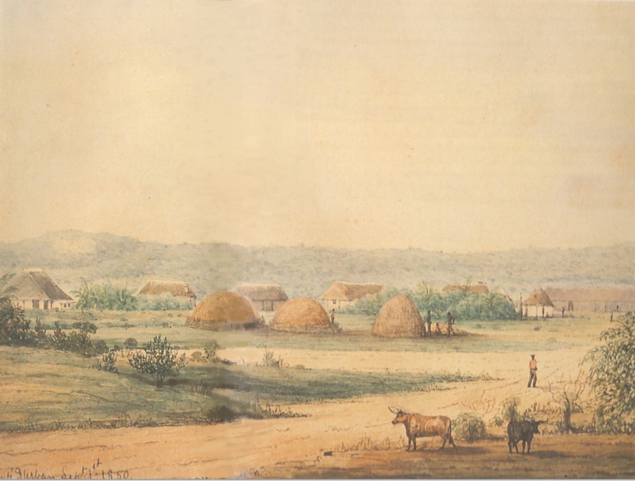
(below) A watercolour painting by P. L. G. Cloete of the early D’Urban township, 1850. The ridge is visible in the background. It was on this eminence that Gardiner built his mission Station ‘Berea’. Cloete had built a wattle and daub house at the settlement..
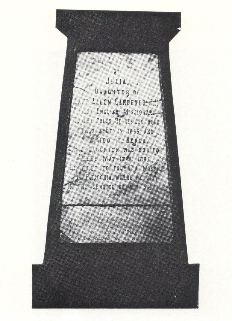
Gardiner laboured on for a further 4 years at Natal before leaving for other mission fields, but not before losing a beloved daughter, Julia, who died on a ship en route to Natal. Her remains lie buried on the Berea. It was on a mission to Patagonia that Gardiner was to lose his life 3 years later. He perished on the 6th of September 1851 of starvation on Picton Island, Tierra del Fuego.
(below) Julia’s memorial and gravesite in the little cemetery off North Ridge Road- the lower stone is the original, the upper erected by later generations of Durbanites in her and her father’s honour.
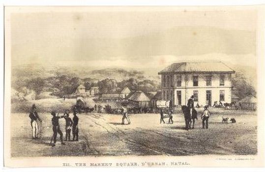
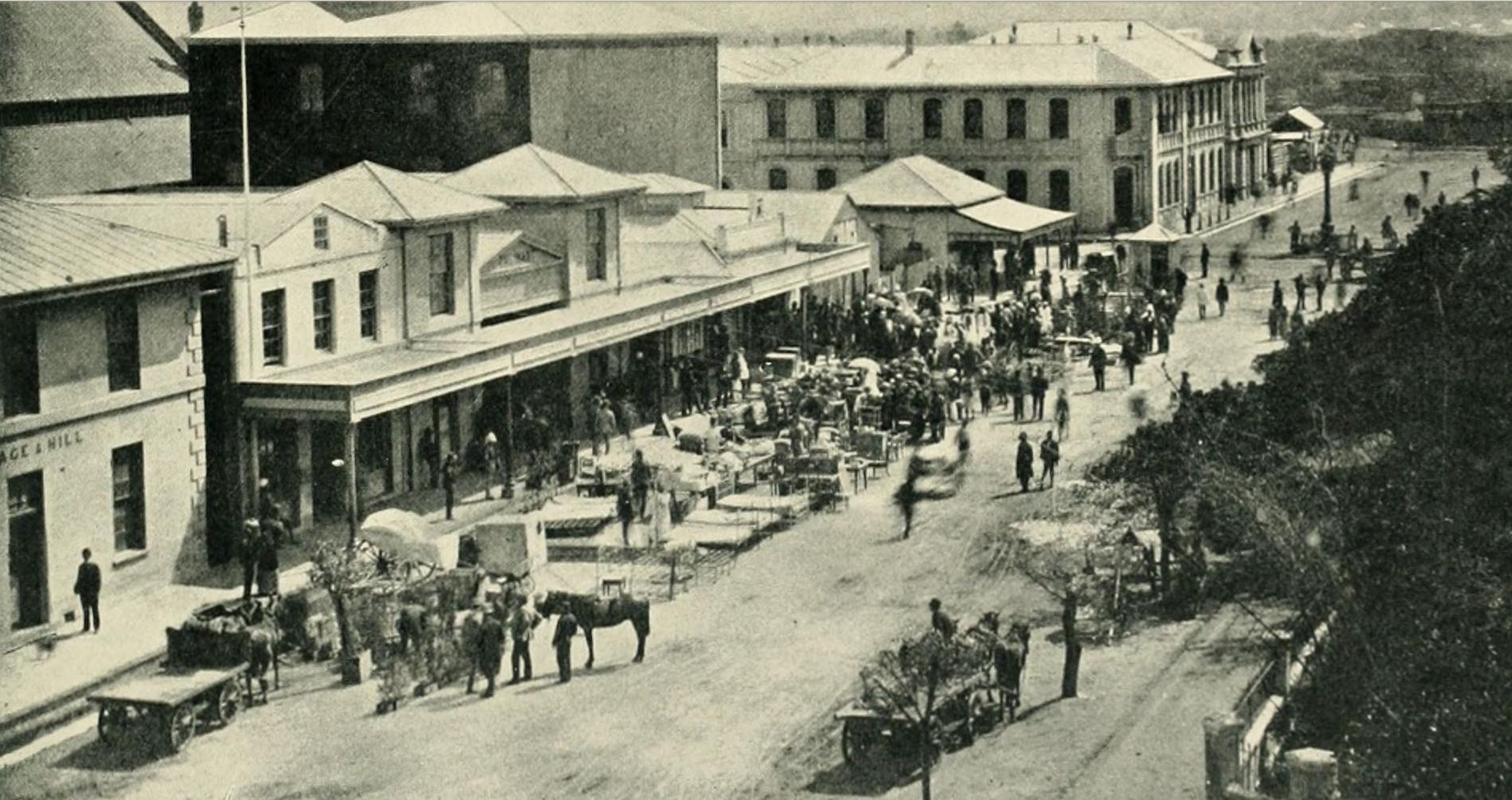
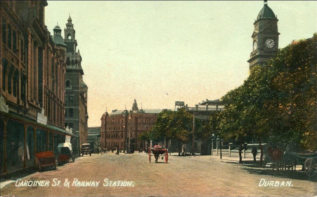
And so it is that one of the city’s major streets were named after Gardiner, the first Christian Missionary to the Zulu nation and founding member of the city of Durban. Gardiner Street was laid-off by Durban’s first Mayor, George Christopher Cato and formed the western boundary of the Market Square. There is little doubt that the intersection of West and Gardiner Street became the most important hub of this busy maritime city.
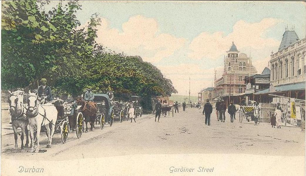
(above) An early photograph of Gardiner Street near the intersection with West Street. Where the man stands with hand on his hip, the Natal Bank was later built. The structure in the background is the first Durban Railway Station, built on the north side of the Market Square. The rutted and sandy nature of the unhardened streets are evident in this image.
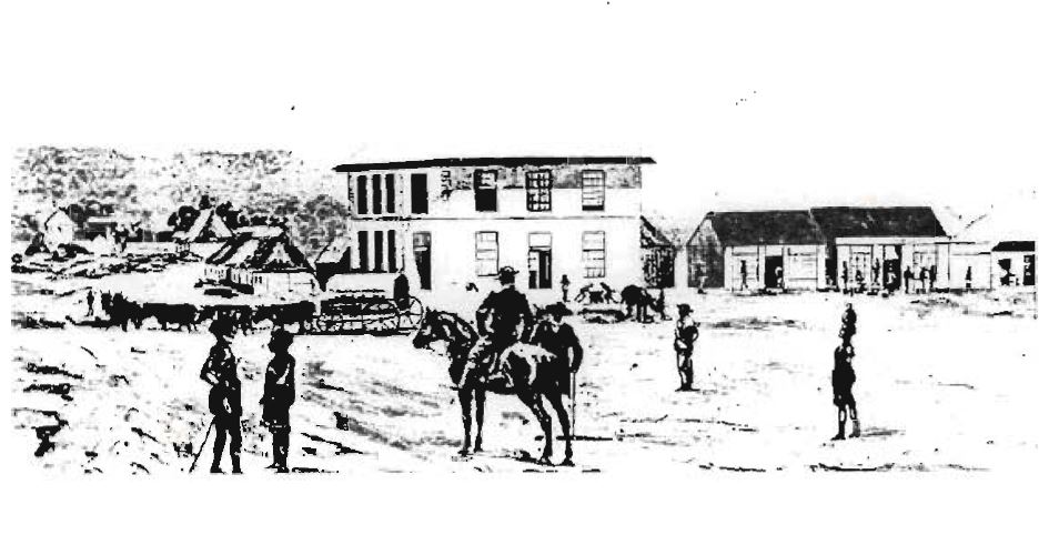
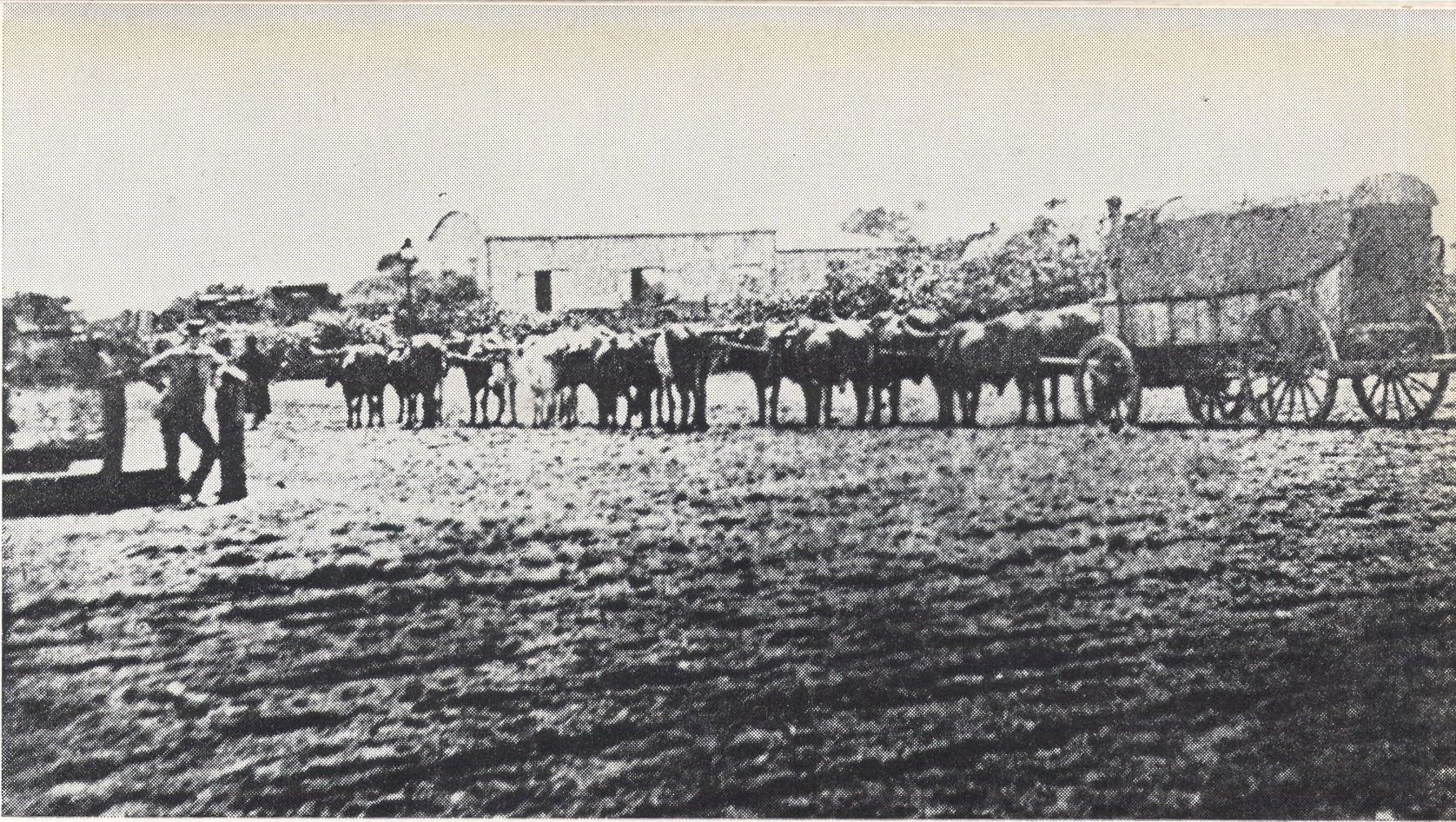
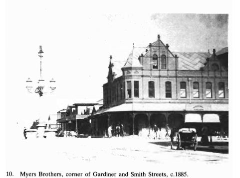
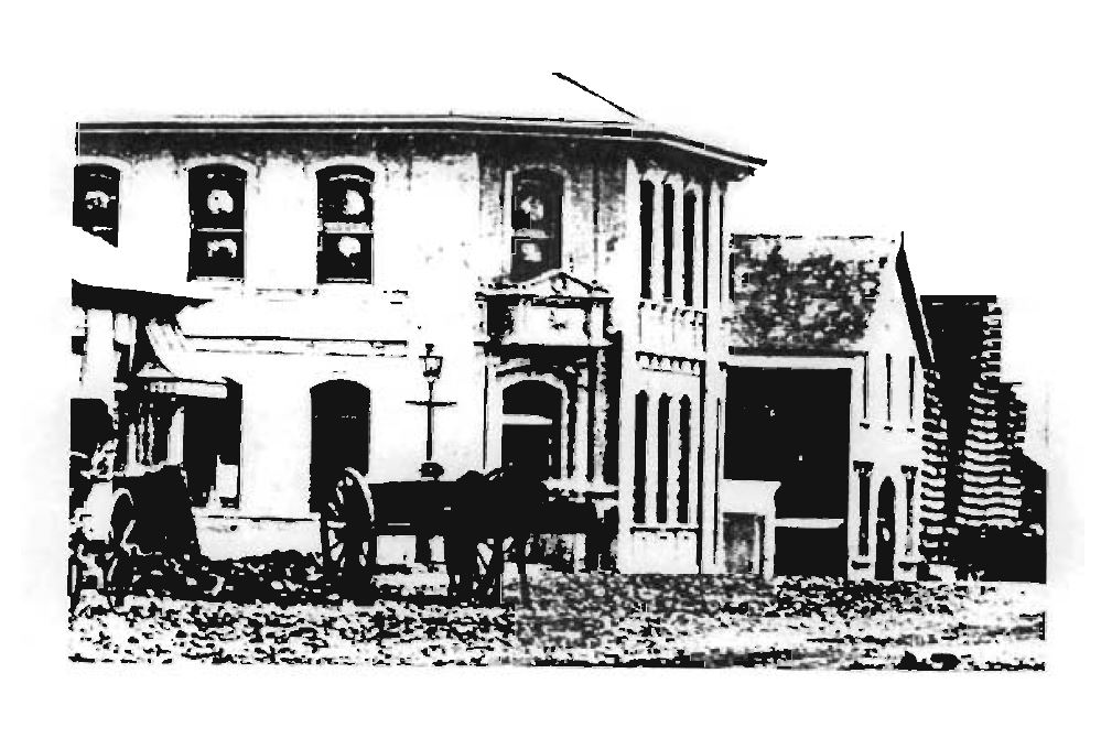
(above and below) Drawings of Gardiner Street. The structure in this image is the first double storied building erected in Durban. It was built on the corner of Smith and Gardiner Streets for Middleton, Acutt and Wirsing in the early 1850’s. (see the image below for a later comparison of the same building). The upper floor of this structure was hired by the government as a Magistrate’s Court and Offices, and one room on the ground floor as the Post Office. The small thatched dwelling further along the street (above the ox wagon) is the home of Johann Friedrich Kahts. Kahts (erf 14 block G) who arrived in the 1830’s and was a Landing Agent and the German Consul for the city of Hamburg. His descendants still live in Natal.
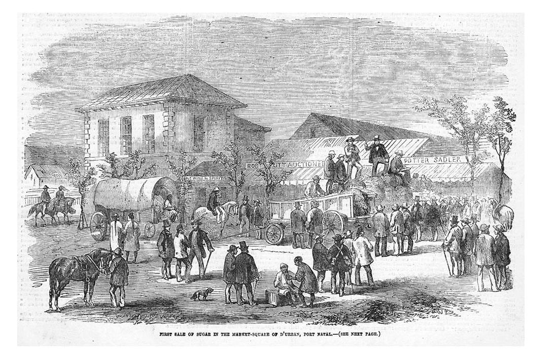
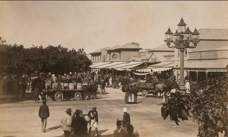
(above) An engraving taken from a drawing executed from the Market Square in 1856. It records the first sale of Natal grown sugar in Gardiner Street, Durban, 1855. Note the double storied Middleton, Acutt and Wirsing store, as well as Rob Acutt Auctioneers to its right (Acutt’s Mart – as it was known). Alongside can be made out a sign ‘Potter Sadler’ – the enterprise of George Potter who was an early Natal Settler and a Saddler by trade. He built this structure material salvaged on the Bluff from the wrecked ship ‘Minerva’. The entrance to the Trust Arcade lies approximately where Potter had his Saddlery.
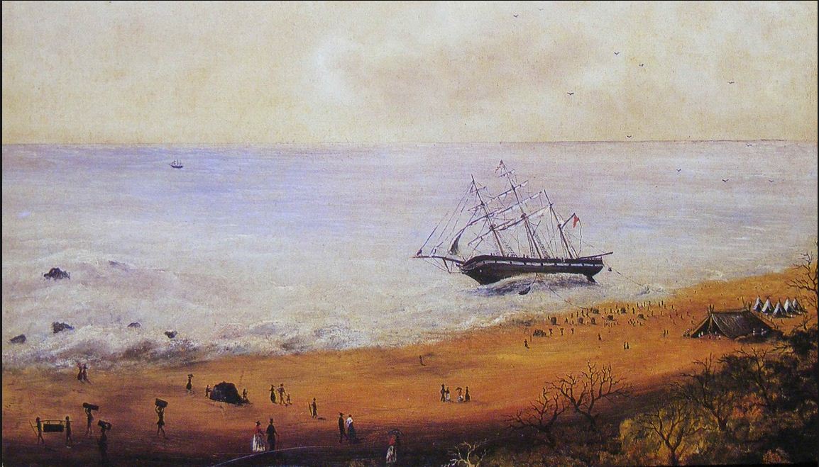
(below) A painting of the wrecking of the settler ship ‘Minerva’ on the 4th of July 1850 on the Bluff headland.
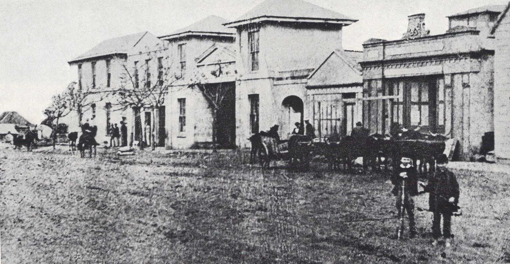
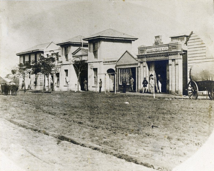
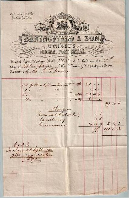
(above and below) The western section of Gardiner Street between the intersections with Smith and West Street. Kahts’ thatched establishment is visible in the far left of these photographs. circa 1860. In the image below (where several men are standing) we can see the business enterprise of Pioneer Samuel Beningfield (Auctioneer).
(above) A photographic view from the Market Square towards Gardiner Street. The buildings in the middle of this image are those portrayed in the image above.
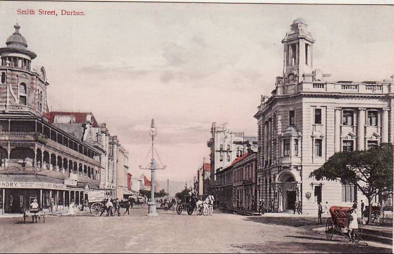
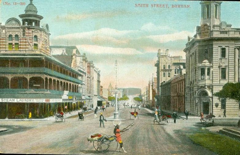
(above) An early view along Smith Street towards the intersection with Gardiner Street. The building on the right is Middleton, Acutt and Wirsing built in the 1850’s.
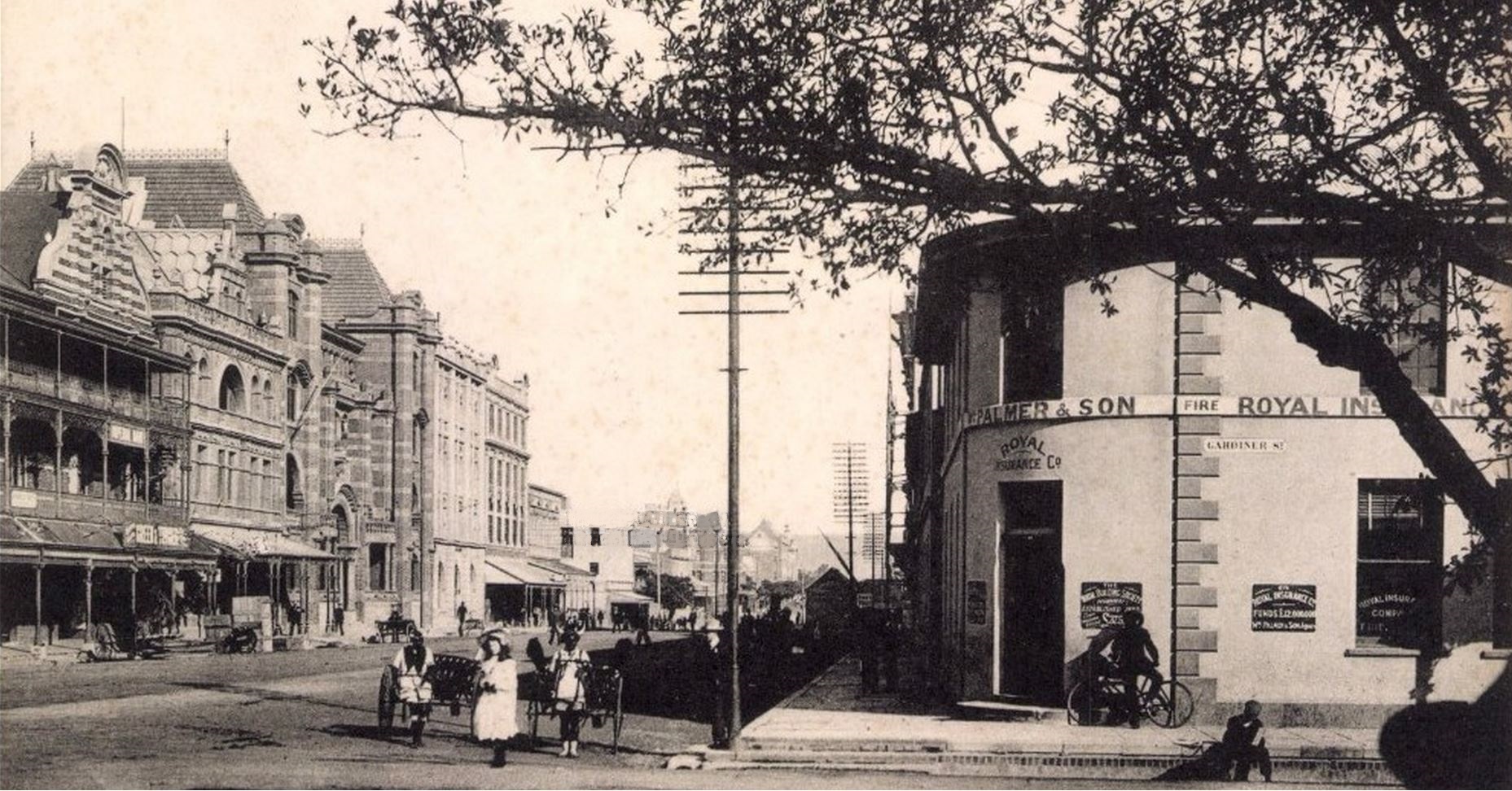
(below) A comparative view looking along Smith Street and the intersection with Gardiner Street. Note that the smart new structure where the Middleton, Acutt and Wirsing and later Willaim and Palmer & Son were located.
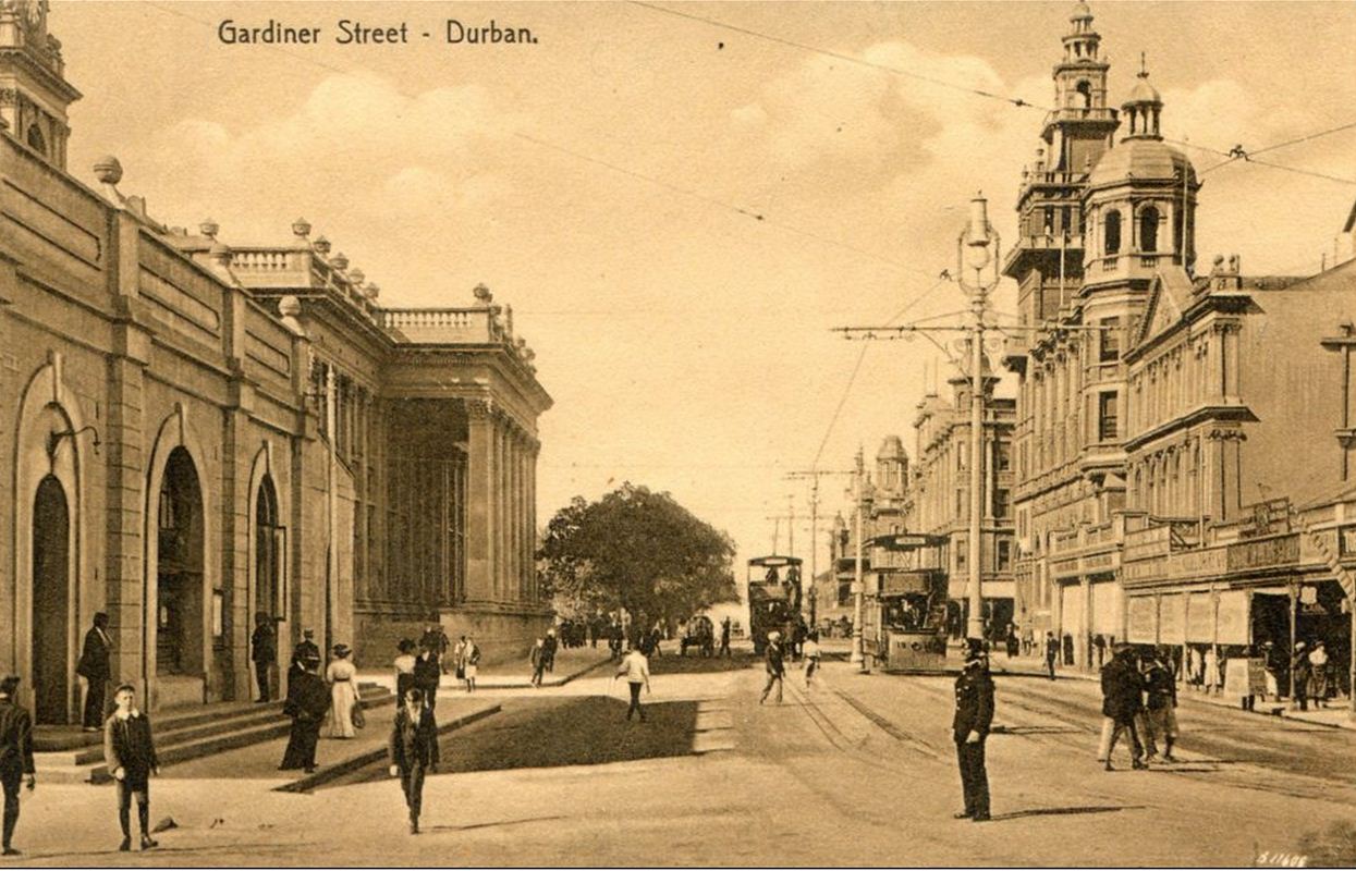
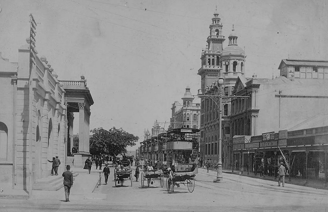
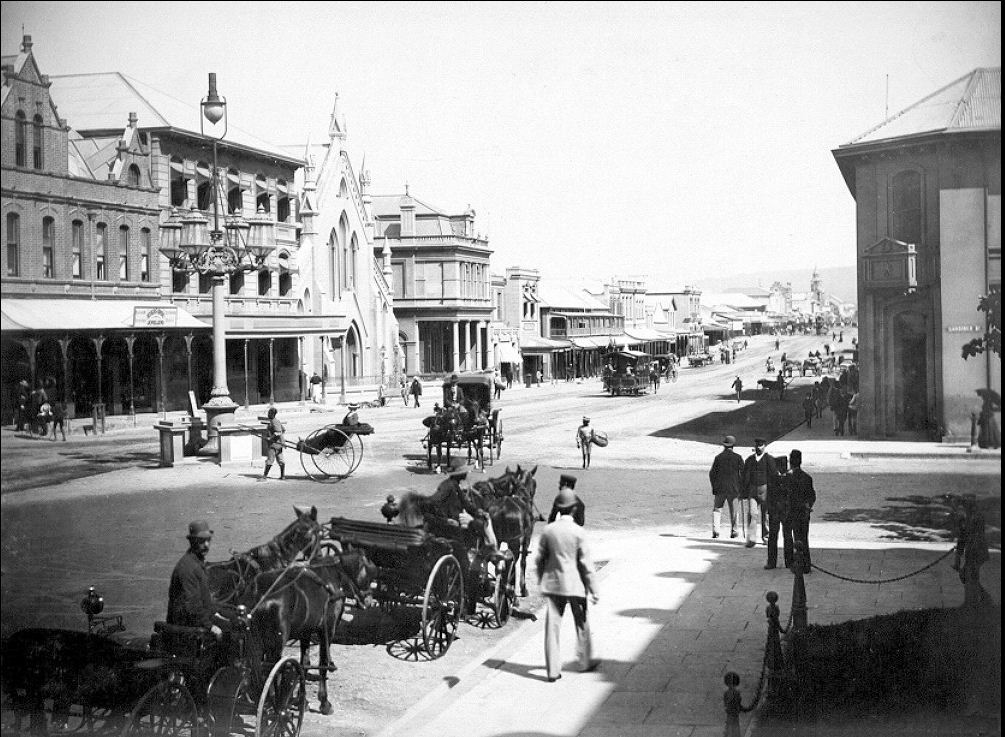
(above) the intersection of Gardiner Street and West Street, looking south down Gardiner Street. Note the ornate street light. These were erected when Durban was electrified in 1897. The assembled Durbanites present to attend an auction.
(above) A photograph of the western side of Gardiner Street. The Middleton, Acutt and Wirsing Building can be seen on the far left. On the eastern side of the street is the Town Gardens. In the distance you can note the intersection with West Street and the corner entrance to the Natal Bank.
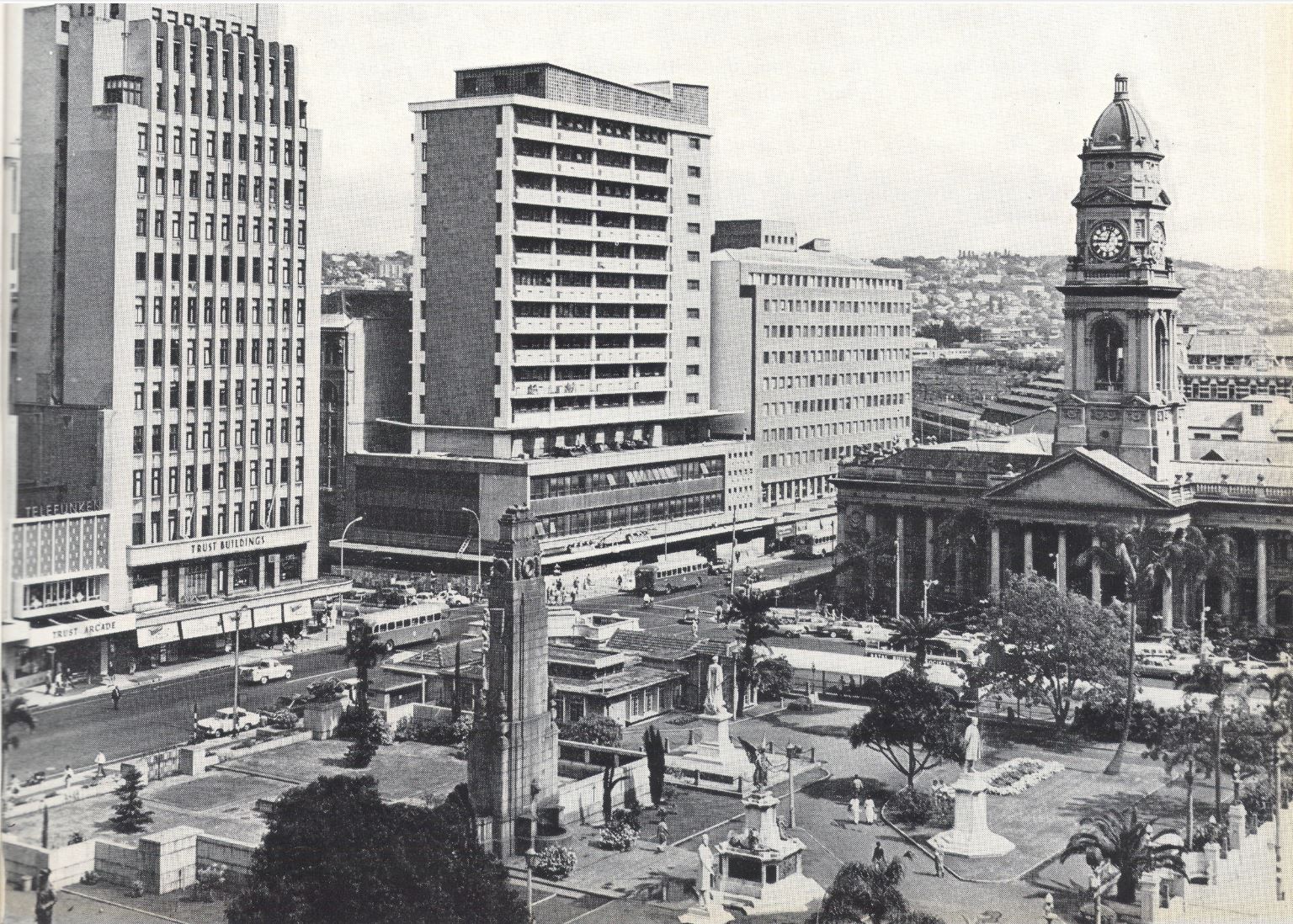
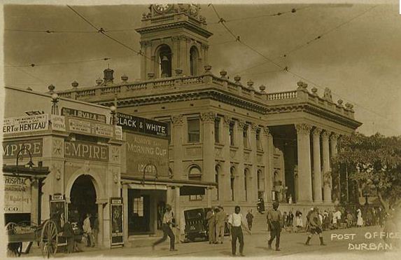
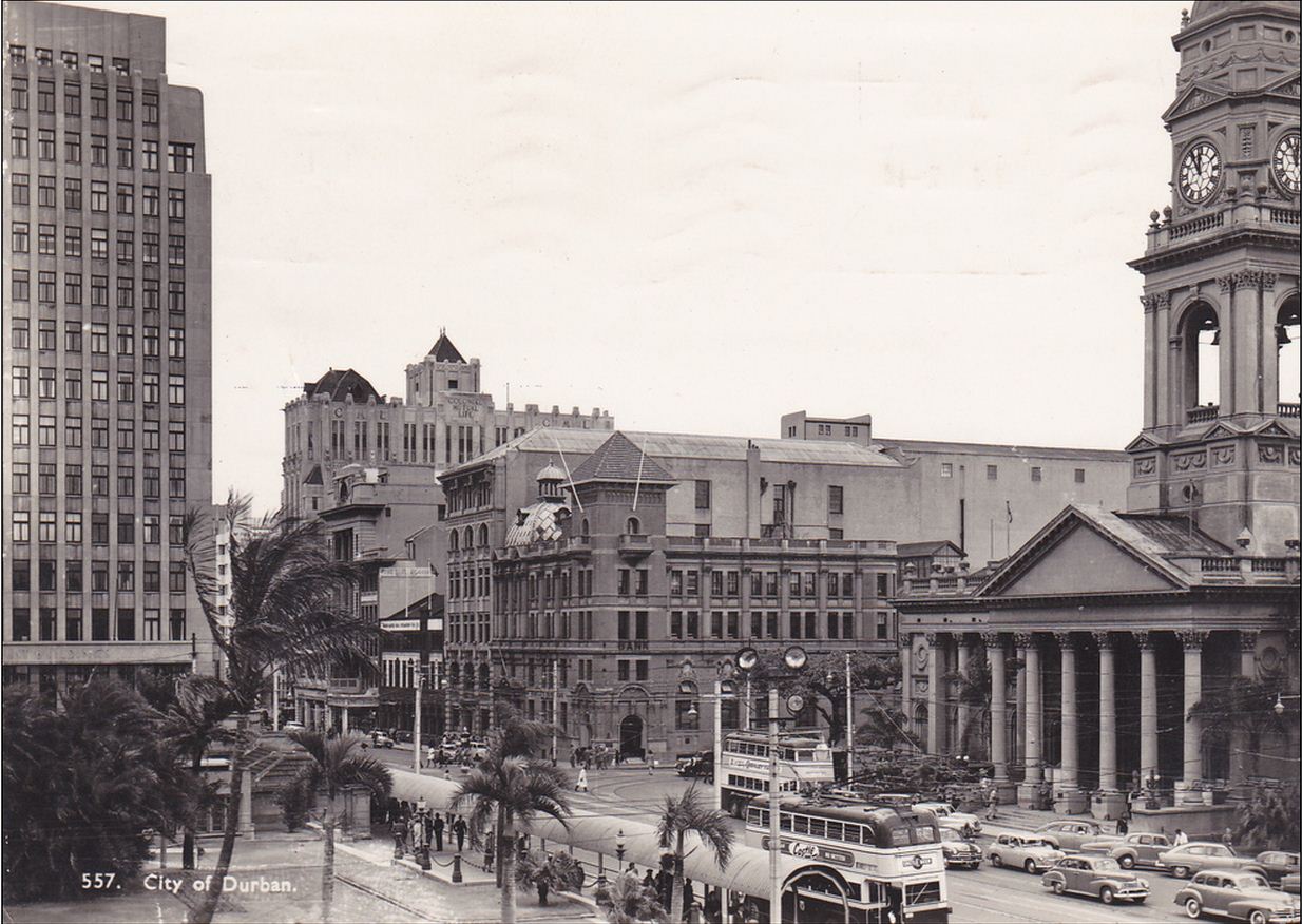
(below) A comparative photograph from 1968 of the same section of Gardiner Street and intersection with West Street as in the image above. The Great War Memorial can be seen in the foreground, including Queen Victoria’s jubilee statue, as well as that of Harry Escombe. The Post Office (formerly the Town Hall) is on the right of the image.
(above and below) Photographs looking west, up Smith Street. On the right of the top image is the original ‘Middleton, Acutt and Wirsing’ building, later the offices of ‘William Palmer and Son’ – Attorneys and Estate Administrators. Note the new building reflecting greater financial prestige and prosperity. The building on the left is the Myer’s Brothers Building.
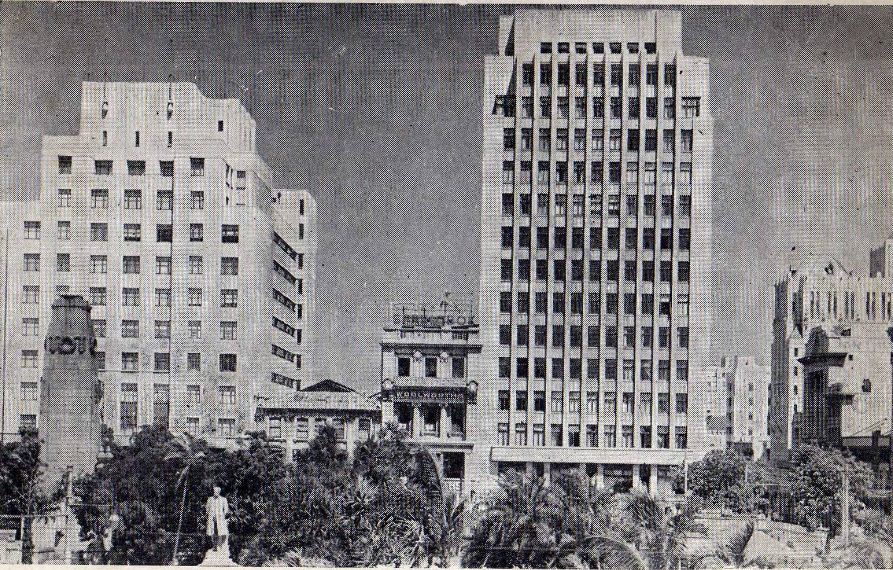
(above and below) Gardiner Street and a view of the Myer’s Brothers Building located on the corner with Smith Street. All these Victorian and Edwardian buildings have been raised to the ground with the march to modernise in the 1950’s to 1980’s. Sadly, very little of the original town and its charm remains.
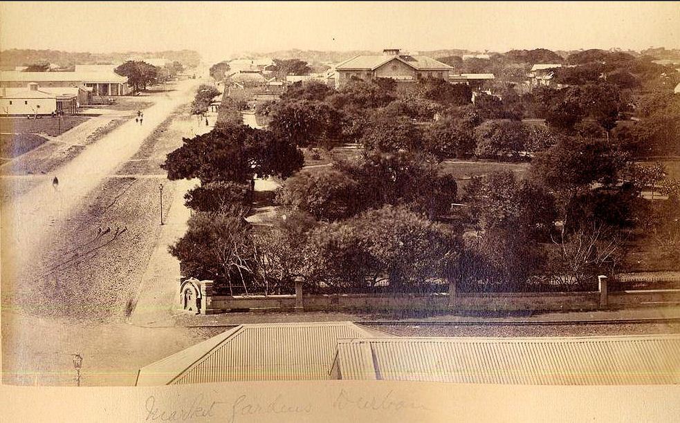
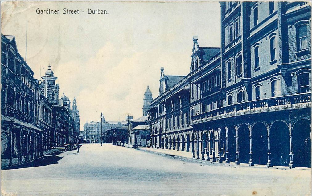
(below) An early view of Gardiner Street lying horizontally and West Street running east. Note the Town Gardens now surrounded by a wall, with the Old Law Court at the garden’s top end. The open field on the far left is a remnant of the old Market Square, now the Medwood Gardens.
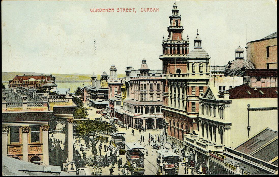
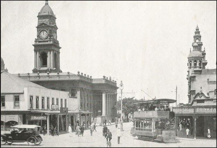
(above and below) The upper end of Gardiner Street in front of the old Town Hall where the trams stopped and left from.
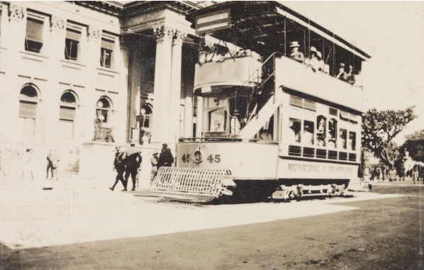
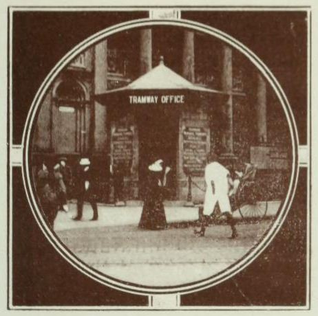
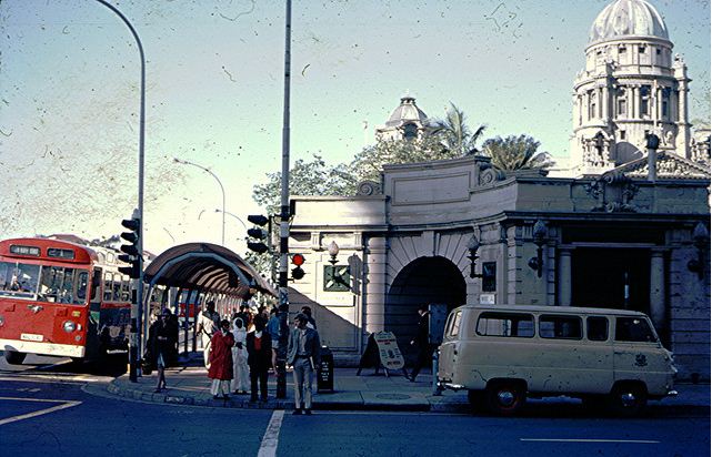
(below) The Tramway ticket kiosk located on the corner of Gardiner and West Street, opposite the Town Hall.
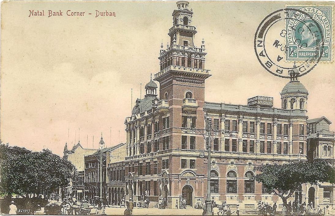
(above and below) A photograph looking south along Gardiner Street towards the Bay. The structure on the left is the Post Office while the impressive structure with tower is the Natal Bank. This was a terminal location for the electric trams that traveled down West Street towards the Berea.
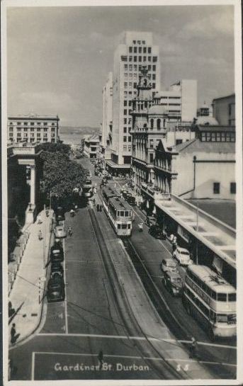
(below) The same photographic view as that of the two images above, but taken in the 1950’s.
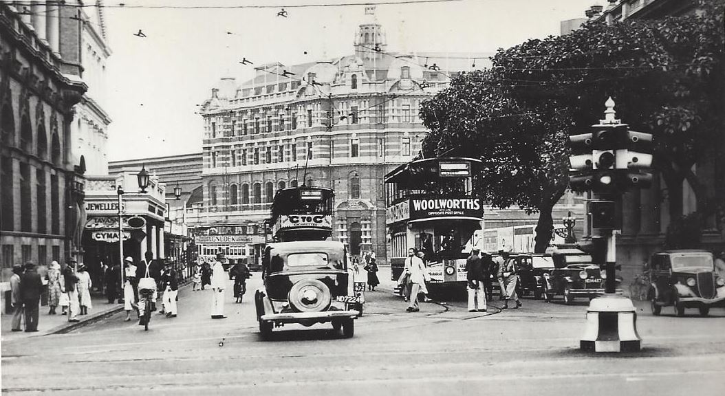
(below) Looking north along Gardiner Street towards the Durban Railway Station. 1940’s. An early traffic light (known locally as robots) can be seen in this image. On the right is the ‘Dead Man’s Tree’ – so named for the obituaries nailed to its trunk, which was needlessly axed by the city’s councilors in the 1950’s. A section of the trunk is kept at the Old Court House Museum in Aliwal Street.
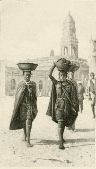
(above and below) A view along Gardiner Street towards the Town Hall (later the Post Office). In the fascinating drawing below we see three Zulu women traversing the street and carrying produce on their heads as is their custom.

(above and below) Two views from the intersection of Gardiner and West Street looking north in the direction of the Durban Railway Station. Note that in the lower image the double tramlines round this corner to stop in front of the Post Office.


(above) The Natal Bank. The first bank was located in Aliwal Street, before this structure was built on the corner of Gardiner and West Streets.
(above and below) The Natal Bank. In the upper image we have the earlier structure, which was followed by prestigious structure shown in the lower image (sadly demolished).
(below) The upper northern end of Gardiner Street where it meets up with Soldier’s Way. 1920’s.
(below) The upper northern end of Gardiner Street. Note the Empire Cinema to the left of this image.
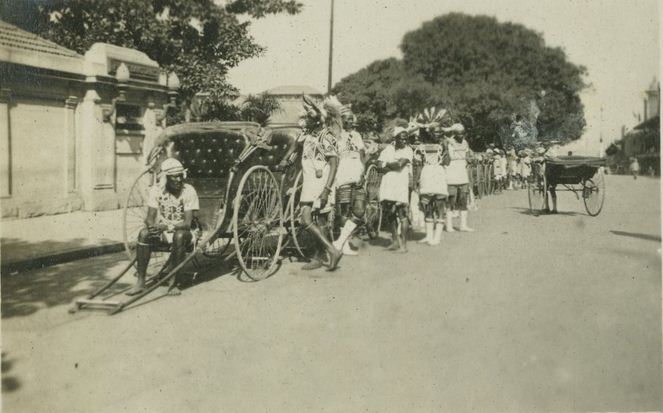
(above and below) A view of Gardiner Street looking south with the Town Gardens to the left. Horse-drawn cabbies and Riskshas would line up along this section awaiting their fares.
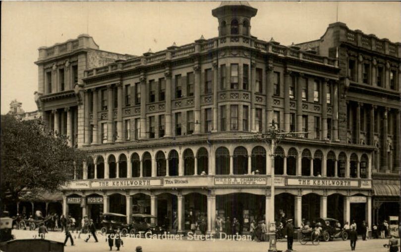
(below) The Kenilworth Building and Tearooms were located on the intersection of Gardiner with West Street, with Reed & Champion, the Chemists on the corner.
(below) The intersection of Gardiner and West Street, looking west along West Street. The earlier Natal Bank is on the right.
(above) The drinking fountain that was donated by William Hartley for the wellbeing of all Durbanites in 1862. Seen here positioned on the corner of Gardiner and West Streets. The fountain is today located in the Durban Botanic Gardens, minus its turret.
(below) A view of the intersection of Gardiner and West Street, viewed from the Town Gardens. You will note that the Natal Bank has lost the upper section of its tower. 1950’s.
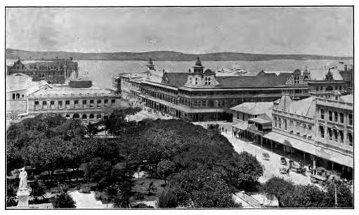
(below) A view from the Post Office clock tower, across the Town Gardens, towards Myer’s Brothers building in the middle.

(below) A photographic view of the buildings in Gardiner Street from the Town Gardens. All these buildings have now been demolished and been replaced by taller structures in the last 20 years.
(below) The intersection of Gardiner and West Street photographed in 1968. The City Hall is in the background with the Public Toilets in the foreground.
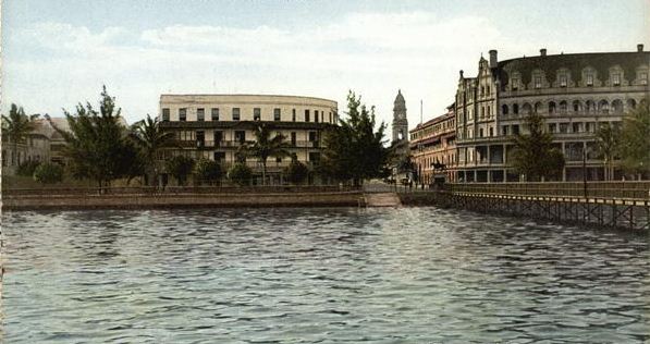
(below) Gardiner Street, looking north towards the Durban Railway Station in the distance. The Marine Hotel is on the right and Twines Hotel on the left.
(below) The southern end of Gardiner Street where it it forms a T-junction with the Victoria Embankment. Twines’s Hotel is on the left. This hotel was built in 1902 and closed in 1962. On the right the Marine Hotel is under construction.
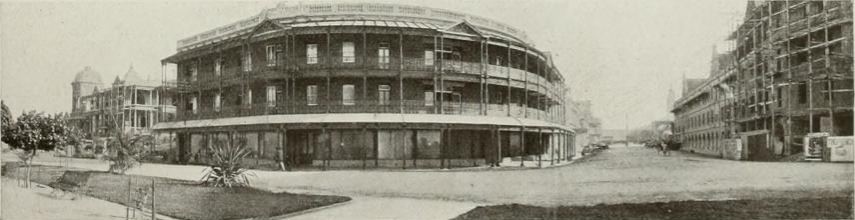
(above and below) two photographic views looking north along Gardiner Street from the Victorian Embankment. The Marine Hotel is on the right, while Twine’s Hotel in on the left.
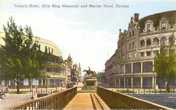
(below) A view looking north from the Gardiner Street jetty, with Dick King memorial in the middleground.
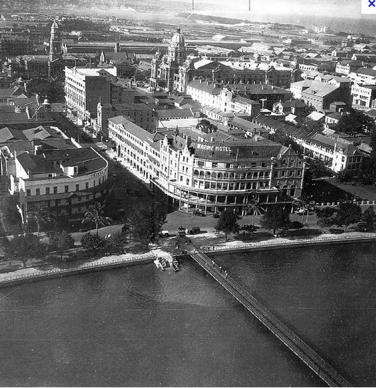
(below) An aerial view of the intersection of Gardiner Street and the Victorian Esplanade.
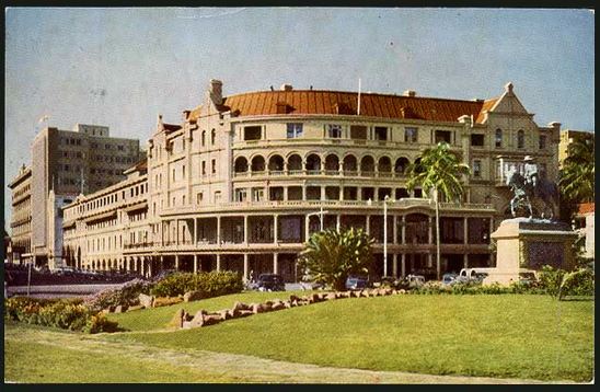
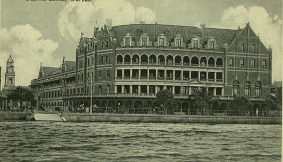
(below) An earlier comparative image of the Marine Hotel and lower southern end of Gardiner Street. Note the remodeling of the Marine Hotel in the upper image. This building was tragically demolished in 1972. With it went much of the earlier appeal of the town, to be replaced by nondescript modern New International Style high risers.
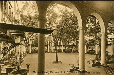
(below) The interior courtyard to the Marine Hotel.
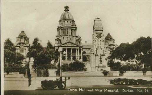
(below) Gardiner Street, looking east towards the Great War Memorial and the City Hall that was built in 1910.
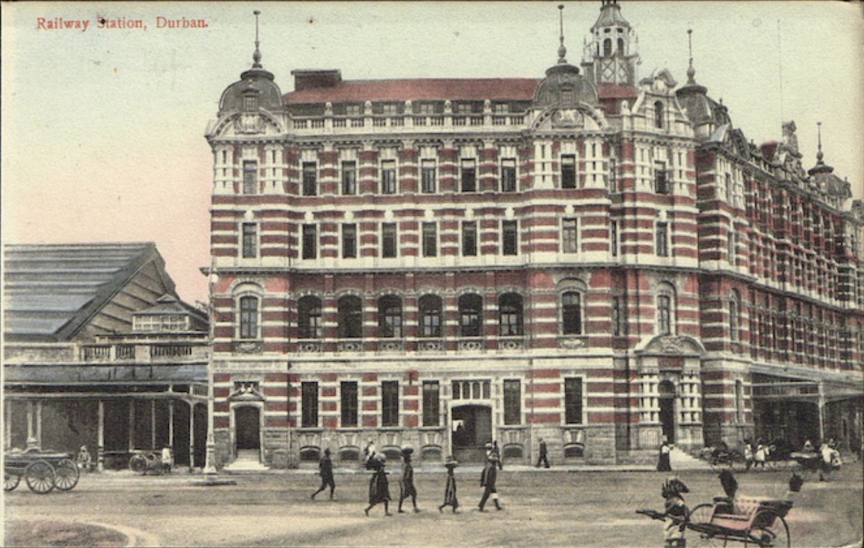
(below) A photograph of the Durban Railway Station. From this point heading north the street is names ‘Soldier’s Way”.
Graham Leslie McCallum

Recent Comments